One of my former graduate students (
Paul Jensen) and one of my current graduate students (
Skyler May) have worked on these Late
Triassic Rocks along the south flank of the Uinta Mountains. They are interesting rocks with interesting sedimentary structures. We traveled out there this week to look at them again.
Panoramic view of one of the ships in the
Red Fleet along the south flank of the Uintas. The particular rocks we are studying are the rocks that make up the "deck" of the ship and the red cliff above the lower slope. The lower slope is the Chinle Formation, the red cliff and deck of the ship are the Bell Springs Formation, and the upper lighter red rocks forming the top part of the ship are the Nugget Sandstone.
Rippled sandstone with small clay lumps on the ripples. As the water flowed past the clay lumps, they allowed sand grains to accumulate in their flow "shadow" showing that the water was flowing from the upper left to the lower right across this bed.
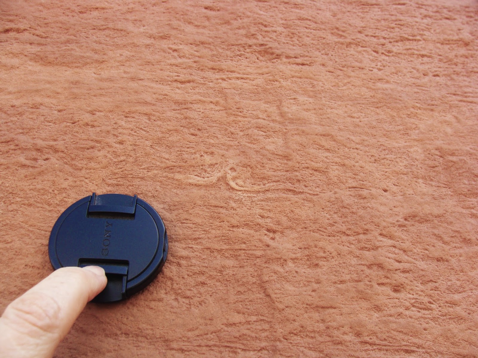
This layer of sand was covered by a thin layer of mud that dried out and cracked. The cracks were then filled in with more sand. Fossilized mudcracks are common in the Bell Springs Formation.
The massive red cliff sandstone is almost entirely composed of ripple laminated, very fine sand as seen in this photo. The individual ripple layers are 1-3 cm in thickness with ripple wavelengths typically 2-6 cm. In places, a few mud lumps are found in the sandstone, as seen near the top of this photo and some ripples have thin mud drapes.
Occasionally, small fluid escape tepees, as seen here, can be found in the rippled sandstone. In addition, the sand is pock marked with small burrows and bioturbation, seen here and below.
Color and b&w shot of bioturbated portion of the red sandstone cliff. Here the burrowing has almost completely destroyed the ripples, although some can still be seen in a place or two.
The small white rectangular blades and rosettes seen on this sandstone surface are salt casts: places where salt crystals grew in the sand and then later dissolved away. This layer of sandstone is at the top of the red cliff and forms the first layer of the deck of the Red Fleet ship.
Standing here on the surface with the salt casts is Doug Sprinkel of the Utah Geological Survey. Between Doug's feet and hat are a series of sand layers that lie like the shingles on a roof dipping to the left. These were likely deposited on the point bar of a small river.
Above the point bar deposits are layers with small cross-bed sets. The lower set seen here has been truncated by a second set. The contact between the two sets (a few inches above the hammer handle) is wavy and the first sand deposited into the waves has layering that follows the wavy boundary before the second sand set becomes established.
Here is a close up of the contact described above. The lower cross-bed set truncated along the wavy surface. Then the sand filling in the waves, then a thin crinkly bed with a slightly darker color, and finally the second cross-bed set.
Crinkly beds in these sandstones as seen here in this 2004 photo, may be due to algal growth on the sand shortly after it was deposited.
Cross-bedded sandstones about 0.5 m in thickness are separated by crinkly sandstone layers near the top of the red cliff in the Bell Springs Formation. This photo was taken in 2004.
Here the Bell Springs Formation is exposed in
Dinosaur National Monument to the east of the Red Fleet section and the big cliff forming sandstone that was characteristic of the formation at
Red Fleet is absent. Photo taken in 2012.
Ron Blakey's
paleogeographic map of the Bell Springs Formation time period. According to his map, northeastern Utah would have been part of a broad fluvial plain stretching out to the west from the highland areas of Colorado to the ocean and island arc along the western margin of North America.