Tuesday, October 15, 2013

Fall in Provo

Just a few shots around the house and up the canyon mostly at sunset and sunrise.

Moonrise over the Wasatch Mountains.

Undergrowth in the aspens along the side yard.

Maples and fire bush. Yellow Norway maple hangs over a smaller red orange native Utah Bigtooth maple and on the left a bright red winged euonymus, also called fire bush.


Bridal Veil falls in the early morning light up Provo Canyon in the Wasatch Mountains.

Sunset colors in the sky over the cottonwood and maple trees.

Purple alyssum, the last of the summer flowers in the front garden.

Limestones of the Oquirrh Formation in the Wasatch Mountains of Provo Canyon in the early morning.

Remnants of the summer garden. The tomatillos and tomatoes that didn't quite make it.

Burr oak acorns in the gutter in front of the house.

Another view of moonrise over the sunset colored Wasatch Mountains.

Monday, June 3, 2013

Spring West Desert Trip

Each spring I take a trip out into the western Utah desert to collect rock samples for my independent study course. Not many of the desert flowers were in bloom this time, probably because of the dry winter and spring weather. But the desert is still beautiful this time of the year. Here are a few shots I took in between collecting stops.

A little snow still capping Deseret Peak in the Stansbury Range in the distance, and beyond the trees, in the middle distance is a burned out area from a previous year's fire.

A brief stop at the Simpson Springs Pony Express station. What a life those riders must have had.

The colors of the desert are subtle, but beautiful, particularly with the touch of green in springtime.

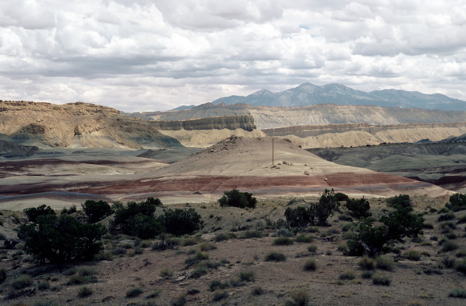
On the north end of the Thomas Range, I stopped to collect some rhyolite. I also found a few pink topaz crystals and some pseudobrookite.

At the stop to collect rhyolite, one lone sego lily was blooming in the middle of the dirt road.

It seemed like every few miles I had to stop and chase one of these off of the road so that it would not get run over. This is the Great Basin gopher snake that is very common and useful in the western Utah desert.

These are really beautiful animals and I always hate it when I don't see them quick enough to stop.

Just east of the Thomas Range, these pointed volcanic hills form the end of the Keg Mountains.

I stopped in the Desert Mountains to collect some quartz. These low hills and mountains located just south of the road between the Thomas Range and the Little Sahara sand dunes have always fascinated me with their variety of different igneous rocks and dikes. But you want to arrive in the spring when the June grass (or cheat grass as it is also called) around the hills has not dried out. When it dries, its seeds gets into every crack and crevice in your boots and shoes and work their way in until you have to remove socks and shoes and pick them out.

Snakes aren't the only reptiles roaming the desert.

Crossing the railroad tracks east of Little Sahara reminded me of the dreadful day two years ago when my wife and I were the first ones on the scene of a terrible tragedy. Three young teenage girls killed by a train.

From the highway east of Eureka, Utah the view of Mount Nebo is spectacular. Snow from this winter still fills the three ancient cirques at the top of the mountain that were carved out during the last ice age.

Here in this black and white shot you can see the cirques even more clearly.

One last shot of Mount Nebo as the sun begins to get low in the sky. This one taken from near the town of Goshen.

These two pictures are of the setting sun striking West Mountain with the town of Genola visible at its base. At the top of West Mountain, not seen in these photos, is the BYU West Mountain Observatory. Beyond West Mountain, civilization once again intrudes upon the desert and I catch the freeway back to Provo. But it was great to escape even for just one day.


Tuesday, April 30, 2013

Geology Photos from My Travels and Laboratory

These are just a few 35 mm slides that I have scanned from my old collection of places and interesting geological things.

Dunes of unique white sand at White Sands National Monument, New Mexico. The sand is made up entirely of crystals of gypsum, a very soft mineral, that is quite different from typical sand made of the mineral quartz. 

 Tracks or trails made by the fission of uranium atoms in the mineral apatite. These "fission tracks" are used to calculate the time at which the apatite grains cooled below about 100 ÂșC. They have been revealed by etching the apatite briefly in an acid solution. These particular apatite grains come from the Middle Jurassic Carmel Formation of southwestern Utah.

Mafic (dark) inclusions in granite in the Sierra Nevada along the Merced River just outside of Yosemite National Park. The dark inclusions are older rocks that were picked up as the granite magma intruded up into the Earth's crust. They did not completely melt in the liquid, molten granite, however, and you can see how the large dark inclusion cracked and some of the liquid granite oozed up into the crack.

Cracks in a solid piece of granite illuminated by a fluorescent dye that was infused into the cracks. The photo is about 3 mm across and shows the pathways for fluid movement in something that appears so solid and impervious as a piece of granite.

This photo is of a volcanic mudstone layer in the Green River Formation located in Indian Canyon south of Duchesne, Utah. The cracks are filled with hard silica, which likely dissolved out of the volcanic material (white stuff) around the cracks. The photo is about 2 feet across (0.6 m).

A fall scene looking down Pole Canyon toward Provo Canyon near Provo, Utah. The mountain on the right side of the photo is Cascade Mountain. The gray cliffs exposed above the maple covered slopes are composed of limestones and sandstones of the Oquirrh Formation (Pennsylvanian-Permian in age).

View to the east from near Capitol Reef National Park. The low hill in the middle of the picture with the brick red stripe at the bottom is the Morrison Formation (Late Jurassic) capped by some sandstones of the Cedar Mountain Formation (Early Cretaceous). Behind the hill are the gray slopes formed by the Tununk Shale Member of the Mancos Shale (Cretaceous), which are capped by tan sandstones of the Ferron Sandstone (Cretaceous). In the far distance, the Henry Mountains peaks can be seen. The Henry Mountains are composed of diorite porphyry intrusions of Oligocene age.

Sunday, April 21, 2013

The Mountain in Our Backyard -- Mount Timpanogos

Here are a few shots I have taken over the years of one of nature's most beautiful mountains: Mount Timpanogos in the Wasatch Mountains of Utah. Even though Timp is only 11,752 feet high, it rises abruptly from Utah Valley, with an elevation difference of over 5,000 feet. The upper parts of the mountain were glaciated during the last ice age, carving the top into its present form.

Most of the mountain is comprised of the Oquirrh Group, a series of Pennsylvanian-Permian age limestones and sandstones that were deposited in the ocean about 300 million years ago when Utah was at the edge of the North American continent. The rocks have since had an interesting history including deep burial, uplift, and erosion to form them into the current spectacular mountain. Several of the photos here were taken from my backyard and others as I have traveled around the mountain.


Monday, January 21, 2013

Red Cliffs, Washington County, Utah - January 2013

When the weather is not so good in northern Utah in January, you can always head south where the sun is usually shining. Here are a few photos I took on my way home from a conference in St. George, Utah at the Red Cliffs Recreation Area and preserve. Also included are a few pictures of the rocks around the Quail Creek reservoir.

 Red Cliffs with Pine Valley Mountains peaking through on the right.

 Narrow underpass under the I-15 freeway to access the Red Cliffs Recreation Area.

 Historic Orson Adams home at Red Cliffs with arch in background.

Historic Orson Adams home. The home was built between 1862 and 1865. Orson Adams was a veteran of the Mormon Battalion. The Adams house is the only intact structure that remains of the short-lived Mormon pioneer settlement of Harrisburg.

Sandstone outcrops near the Red Cliffs campground.

More sandstone outcrops  near the campground.

Pine Valley Mountains, a granite intrusion, in the rear with the Red Cliffs in front. The granite intruded into the area about 20-21 million years ago, warping up the surrounding rock layers. This type of intrusion is called a laccolith.

Map showing the location of the Red Cliffs Recreation Area and campground.

 View of the Pine Valley Mountains in January.

Scattered granite boulders washed out from the Pine Valley Mountains.

Virgin anticline (fold) at the north end of the Quail Creek reservoir. The thin sandstone cliff capping the top of the hills is the Shinarump Conglomerate Member of  the Triassic Chinle Formation. The darker red and lighter striped red and gray rocks below are the Upper Red Member and Shnabkaib Member of the Triassic Moenkopi Formation.

Exposures along the west side of Quail Creek reservoir of the Triassic Moenkopi Formation capped by a thin ledge of Shinarump Conglomerate. The dark brick red rock layers are the Upper Red Member of the Moenkopi and the lighter reddish pink and gray layers are the Shnabkaib Member of the Moenkopi, where the gray layers are mostly gypsum.