Dunes of unique white sand at White Sands National Monument, New Mexico. The sand is made up entirely of crystals of gypsum, a very soft mineral, that is quite different from typical sand made of the mineral quartz.

Tracks or trails made by the fission of uranium atoms in the mineral apatite. These "fission tracks" are used to calculate the time at which the apatite grains cooled below about 100 ºC. They have been revealed by etching the apatite briefly in an acid solution. These particular apatite grains come from the Middle Jurassic Carmel Formation of southwestern Utah.

Mafic (dark) inclusions in granite in the Sierra Nevada along the Merced River just outside of Yosemite National Park. The dark inclusions are older rocks that were picked up as the granite magma intruded up into the Earth's crust. They did not completely melt in the liquid, molten granite, however, and you can see how the large dark inclusion cracked and some of the liquid granite oozed up into the crack.

Cracks in a solid piece of granite illuminated by a fluorescent dye that was infused into the cracks. The photo is about 3 mm across and shows the pathways for fluid movement in something that appears so solid and impervious as a piece of granite.

This photo is of a volcanic mudstone layer in the Green River Formation located in Indian Canyon south of Duchesne, Utah. The cracks are filled with hard silica, which likely dissolved out of the volcanic material (white stuff) around the cracks. The photo is about 2 feet across (0.6 m).

A fall scene looking down Pole Canyon toward Provo Canyon near Provo, Utah. The mountain on the right side of the photo is Cascade Mountain. The gray cliffs exposed above the maple covered slopes are composed of limestones and sandstones of the Oquirrh Formation (Pennsylvanian-Permian in age).
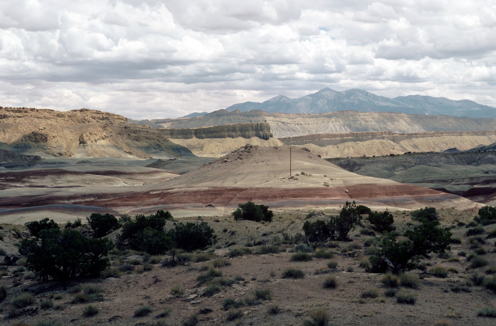
View to the east from near Capitol Reef National Park. The low hill in the middle of the picture with the brick red stripe at the bottom is the Morrison Formation (Late Jurassic) capped by some sandstones of the Cedar Mountain Formation (Early Cretaceous). Behind the hill are the gray slopes formed by the Tununk Shale Member of the Mancos Shale (Cretaceous), which are capped by tan sandstones of the Ferron Sandstone (Cretaceous). In the far distance, the Henry Mountains peaks can be seen. The Henry Mountains are composed of diorite porphyry intrusions of Oligocene age.